
De-risk site selection before you spend
Draw an area or pick a parcel and get buildable area, fatal flaws, and a ranked view of what clears, backed by 118 layers.
Updated October 2026
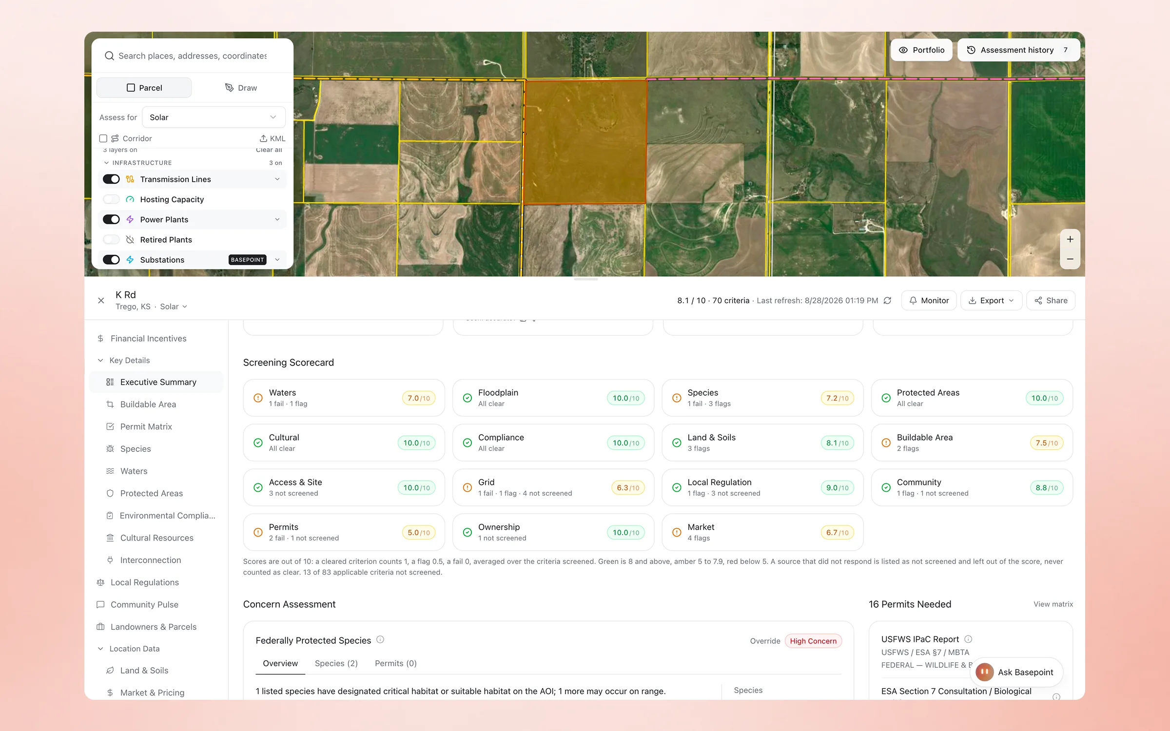
What a screen actually runs
A parcel or a drawn area goes in. What comes back is a scorecard with sources, not a map with a few layers switched on.
Every criterion, scored and sourced
The scorecard grades the parcel across waters, floodplain, species, protected areas, cultural resources, land and soils, grid, permits, local regulation, ownership, market, and community. Each criterion is cleared, flagged, or failed, and each score carries the source that produced it. A source that did not respond is listed as not screened, never counted as clear.
Buildable area, not gross acreage
Setbacks, wetlands, floodplain, steep slope, and exclusions are subtracted from the parcel to give the acreage you can actually build on. Capacity estimates start from that number, so the first-pass megawatts are ones you can repeat to a landowner.
Grid and permits on the same page
The assessment pulls nearest substations, transmission proximity, hosting capacity where the utility publishes it, and the permit matrix for the jurisdiction. The site's interconnection and permitting posture sit next to its environmental one, before anyone drives out.
From one parcel to a region
The same screen runs across a drawn area or an uploaded portfolio and returns ranked candidates. Put a site under monitoring and Basepoint re-runs the screen on a schedule and emails the diff when a layer changes.
Frequently asked questions
How long does a site screen take?
Single parcels and drawn areas screen in minutes. Region-scale origination studies run as jobs and return ranked candidates the same day.
What data is behind the screens?
Eighty-nine layers with per-layer provenance, including parcels and ownership, transmission and substations, hosting capacity, slope, wetlands, habitat, flood, soils, ordinances, and land values.
Can I screen an existing portfolio?
Yes. Upload sites from Excel, CSV, or shapefiles and run the same screens across all of them at once.